Most Amazing Places in Pakistan.
Little is known about tourism in Pakistan compared to many other countries, which makes its utterly dazzling beauty all the more jaw-dropping when you first lay eyes on some of the country’s natural wonders and historic cities. Stretching from the large mountains in the north to the vast Indus alluvial delta in the south, Pakistan is full of natural beauty and stunning mountains. In addition to bright deserts and some of the world’s highest peaks, the country offers numerous attractions for sightseeing, hiking, mountain climbing and skiing.
From palaces of ancient kingdoms gone by to the crystal waters of lakes in vast, sweeping valleys, Pakistan truly does have it all. It is as unique and fascinating as it is breathtaking. Pakistan’s rich cultural heritage and ancient monuments continue to enchant visitors from all over the world. There are a lot of places to visit in Pakistan where you can have memorable experiences, have a look at these most beautiful places for your holiday in Pakistan.
SWAT VALLEY
Swat Valley is a high-altitude tourist destination located in the northwest mountains of the Khyber Pakhtunkhwa province in Pakistan. The Swat Valley is situated on the swat river, at the coordinates of 35°12′N 72°29′E, which is at about 247 Km (153 Miles) distance from the capital city Islamabad in Pakistan. Swat District is a district in the Malakand Division of Khyber Pakhtunkhwa, Pakistan. With a population of 2,309,570 per the 2017 national census, Swat is the 15th-largest district of Khyber Pakhtunkhwa province.

Swat Valley is famous not only for its breathtaking landscape but also for its natural wildlife. It has luscious forests, high peak mountains, and beautiful lakes. Tourists can go hiking, trekking, camping, zip-lining, or just spend time relaxing in nature. In the winters, tourists can enjoy skiing, ice skating, sledging, ice hockey, snowboarding, and speed skating.
HUNZA VALLEY

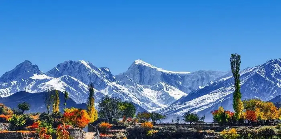
The Hunza Valley is a mountainous valley in the northern part of the Gilgit-Baltistan region of Pakistan, formed by the Hunza River, bordering Ishkoman to the northwest, Shigar to the southeast, Afghanistan’s Wakhan Corridor to the north, and the Xinjiang region of China to the northeast. Hunza Valley is a hidden gem of Pakistan, located in the Gilgit Baltistan province. It is a secluded valley, sitting between the Himalayas and the Karakoram mountain ranges. This fertile valley has agricultural land that has always been a great tourist attraction. It has breathtaking views and is home to warm, hospitable people.
In the mountains of Hunza, there is a sense of tranquillity and seclusion. The raw and rugged mountains make you feel like you’re in paradise. This is a must-visit for those who want to escape the hustle and bustle of everyday life.
BOYUN VILLAGE
Boyun village and the green top are two names of one destination including lush green fields under the feet of gigantic mountains all around and a top-view of the whole Kalam valley. It is a hilltop near Kalam valley where a village named Boyun is located on one side and the other side is known as the green top from where the whole Kalam valley can be seen. Moreover, the lush green fields of potato, wheat, and other seasonal crops between these two are reasoned to eyes cooling.
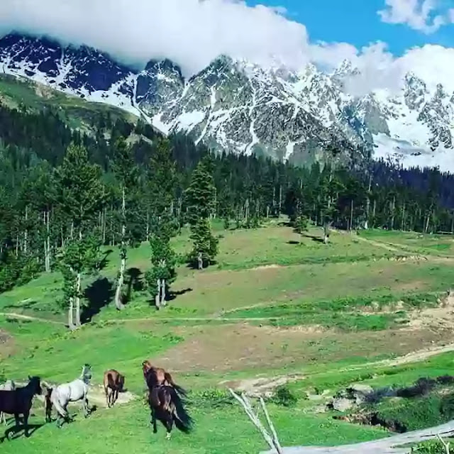
There are several historical and beautiful villages in Swat and Boyun village has a special and distinguished place in it. The majority of people living here are Muslim and follow their century-old culture and traditions. And the ancient and historical Aryani village in Swat is really attractive as well. Green top is famous for its healthy atmosphere and climate where the feel of cold wind on your body is really fascinating. Please keep in mind not to capture pictures of locals without their permission.
YARKHUN VALLEY
Yarkhun is an administrative unit, known as Union Council, of Chitral District in the Khyber Pakhtunkhwa province of Pakistan. The valley consists of 39 villages and hamlets ranging from Breb to Broghill towards the north. The village of Bang is the headquarters of the Yarkhun Union Council.
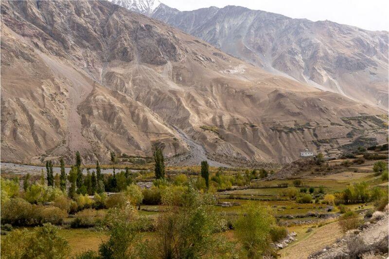
Yarkhun valley is a valley in Chitral Pakistan. The individuals of yarkhun valley are called Khow with an extraordinary ethnic assorted variety in the pages of history. Yarkhun extends between Niwaishiru Sarooz, some 3-4 km down the town Brep, and Lashkar Gaaz of Boroghel. The number of inhabitants in Yarkhun is around 30,000 and its complete length is roughly 150 km. Its limits contact Afghanistan on its North-West and Gilgit-Baltistan on its South-East.
Reaching the valley, which stretches for many kilometers past the administrative town of Mastuj, requires a bit of effort if you don’t have your own vehicle. If you do have one though, the ride isn’t too bad – just prepare for mostly dirt roads! The side valley of Gazin is most definitely worth a detour if you make it all the way to Yarkhun. Here, you can see the mountains of the Thoi Pass, a high-altitude pass that connects Upper Chitral with Yasin Valley in Gilgit Baltistan.
PHANDER LAKE
Phander Lake is situated in the Phander Village, in Koh-i-Ghizer, Gupis-Yasin District, the westernmost part of the Gilgit–Baltistan region and northernmost territory of Pakistan. This lake is an important source of fresh water.Phander Valley is one of the most beautiful valley in Pakistan..It offers spectacular scenic view.. It is very lush green and very pleasant place. A twisting road passes through lush green fields and forests with a view of flowing river and icy peaks lead to this charming valley. From springs of crystal clear waters to lakes and rivers of deep blue water, there are all colors of nature’s beauty in Phandar Valley. Peaceful deep blue waters of River Ghizer and surrounding lush green and golden fields are breathtaking. It takes 5 to 6 hours from Gilgit to reach Phander valley.

There is a lake at the eastern end of the valley named Phander Lake. Phander Lake is one of the most famous tourist spots in the entire region. . The Phandar Lake gives masmerizing views. The deep blue of Phander lake offers a magnificent view. It is very famous for trout fish . Area of Phandar Lake is about 3 kilometers. To reach Phander Lake one has to cross Phander valley from the river to the right and climbs a hill.
BROGHIL VALLEY
Broghil Valley is a valley and national park located in the upper northern reaches of the Chitral District, Pakhtunkhwa, Pakistan, close to the Afghan-Pakistan border. The area is mostly mountainous. Elevations range from between 3,280 m (10,760 ft) at the village of Kishmanjah to 4,304 m (14,121 ft) at Karambar Lake in the northeast. The terrain is undulating with mountains, grassy plains, and valleys. It includes almost 3,400 ha of peatlands and lakes.The valley features around 30 freshwater lakes and is surrounded by glaciers and mountains.
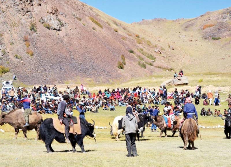
The Broghil valley’s remote location makes it a hard-to-reach tourist destination. Many communities in Broghil lack access to basic facilities and services. The annual Broghil Festival attracts visitors, however it lacks basic road and hospitality infrastructure. Attendees enjoy attractions and activities such as yak polo and exhibitions of woolen handicrafts, accompanied by traditional food and music.
Reaching Broghil Valley is not an easy feat. Although the government is currently working on several development projects to build roads and tourist facilities in the region, as of right now, the dangerous terrain and harsh weather conditions can make it extremely difficult to access this area.
The easiest way to reach Broghil Valley in Chitral is by taking a flight to the small domestic airport in Chitral through Pakistan International Airlines – the only carrier that operates there. From Chitral, it will take you about 4 hours to reach Mastuj Valley by a 4×4 jeep. After resting up for a few hours, you should leave for Kashmanja early in the morning as it would take you about 10 hours, give or take. In ideal weather conditions, you’ll have to travel for about five more hours to get to Ishkarwaz.
HINGOL NATIONAL PARK
Hingol National Park or Hungol National Park is the largest national park in Pakistan, located in the Makran coastal region. The park covers an area of about 6,100 square kilometres (2,400 sq mi) and is located 190 km from Karachi in the three districts of Gwadar, Lasbela and Awaran in Balochistan. Hingol was declared a national park in 1988. The park is named after the southern part of the Hangul River which flows along the shores of the Arabian Sea and is home to large numbers of waterfowl and a wealth of marine life. Hangul National Park contains six distinct ecosystems as well as both desert and plains regions, making it unique among the national parks of Pakistan. The park is bordered by a dense forest to the north, a barren mountain range to the south, and the Hangul River tributary, which is home to thousands of migratory birds and marsh crocodiles. The Gulf of Oman and the Arabian Sea are also to the south.
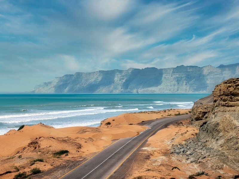
One of the most fascinating places to visit in Balochistan, Hingol National Parks is situated along the Makran Coastal Highway, covering an area of around 1,650 square kilometres. A large chunk of the park is covered with drift sand, which is why it has also been classified as a semi-coastal desert. The park is counted among the most important natural reserves in Pakistan. It partially spreads over three districts of Balochistan including Gwadar, Awaran, and Lasbela, because of which it features a variety of topographical features, from sub-tropical forests to arid mountains.
KALASH VALLEYS
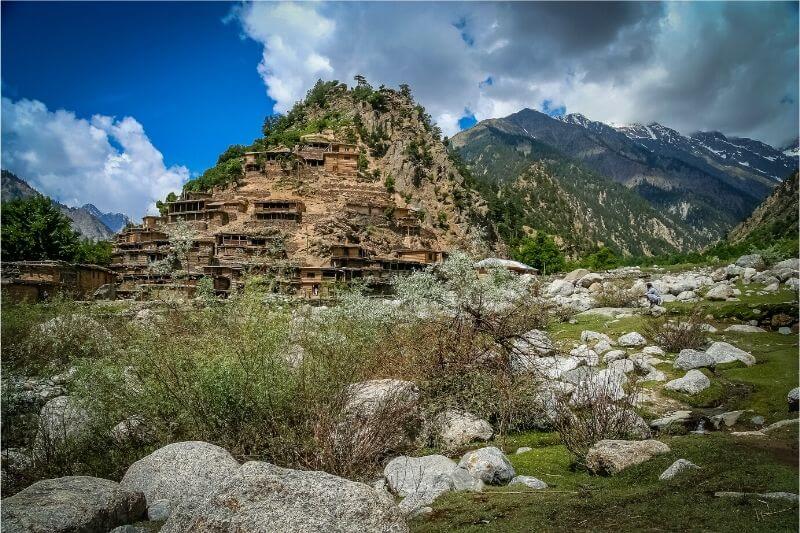
The Kalasha Valleys are valleys in Chitral District in northern Pakistan. The valleys are surrounded by the Hindu Kush mountain range. The inhabitants of the valley are the Kalash people, who have a unique culture, language and follow a form of religion that is associated with their surroundings like the mountains and rivers.The largest and most populous valley is Bumburet (Mumuret), reached by a road from Ayun in the Kunar Valley. Rumbur is a side valley north of Bumburet. The third valley, Biriu (Birir), is a side valley of the Kunar Valley south of Bumburet.
The grandest of all is that the Kalashas carry a romantic view of being the descendents of Alexander the Great. On the other hand, many historians believe that they are indigenous tribe of the neighboring area of Nuristan also called Kafiristan (the land of Kafirs). It is believed that in 1895 Amir Abdul Rahman, the king of Afghanistan, conquered the area of Nursitan and forced the inhabitants of the area to convert to Islam. It was during that time that many people fled to Chitral to avoid conversion. The third theory claims that the ancestors of Kalashas migrated from a distant place in South Asia called Tsiam. The Tsiam is considered to be the traditional home of these people. The Kalasha folk songs and fables hint the existence of Tsiam and that their roots belong in that region.
DEOSAI PLAINS NATIONAL PARK
Deosai National Park is a high-altitude alpine plain (plateau) and National Park located in between Astore, Kharmang and Skardu districts in Gilgit-Baltistan. Most of the area falls in Skardu District. Deosai Plains are situated at an average elevation of 4,114 metres (13,497 ft) above sea level and considered as the second highest plateaus in the world. The Deosai National Park is located in western Himalayas in Gilgit Baltistan (GB), Pakistan. It has an average elevation of 4,114 metres (13,497 ft) above sea level, making the Deosai Plains the second highest plateau in the world after Changtang Tibetan Plateau.[4] The park protects an area of 843 square kilometres (325 sq mi). It is well known for its rich flora and fauna of the Karakoram-West Tibetan Plateau alpine steppe eco-region. In spring, it is covered by sweeps of wildflowers and a wide variety of butterflies.
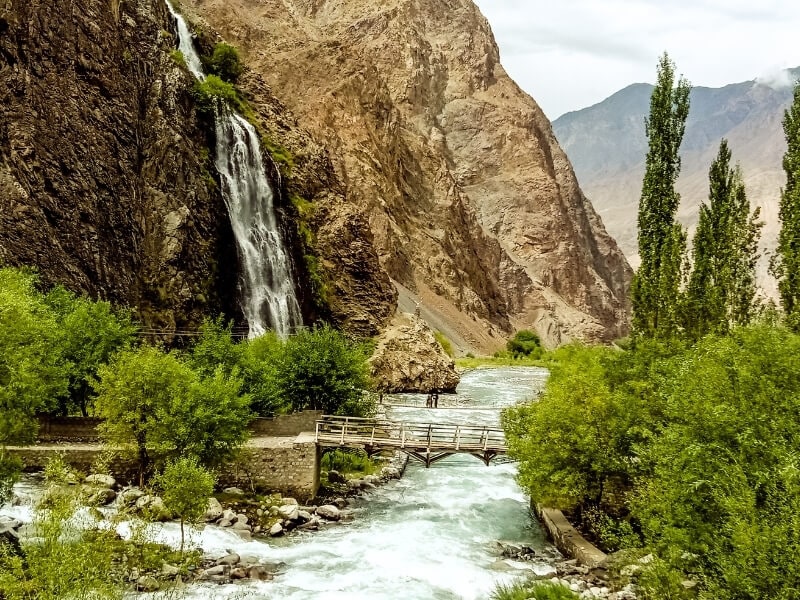
The park is part of the Conservation International Himalayan Biodiversity Hotspot and contains a rich variety of species including a population of Tibetan wolf (Canis lupus chanco), Himalayan ibex (Capra ibex sibrica), Tibetan red fox (Vulpus vulpus montana) and Golden marmots (Marmota caudata). The waters of the Deosai plateau are home to the local snow trout which reach enormous size. The park lies within the BirdLife International’s Western Himalaya Endemic Bird Area and is important as a resting place and breeding ground of residential and migratory birds of international importance. The flora of Deosai is influenced by four major floristic elements: Boreoalpine and Circumpolar; the Euro- Siberian; Southern European/ Mediterranean and Siberian- Mongolian and is home to hundreds of species of medicinal and aromatic plants. In the Spring season it is covered by sweeps of wildflowers and a wide variety of rare butterflies.
GORAKH HILLS
Gorakh Hill is a hill station of Sindh, Pakistan. It is situated at an elevation of 5,689 ft (1,734 m) in the Kirthar Mountains, 94 kilometres (58 mi) northwest of dadu city. Currently The Gorakh Hills summit can only be reached with 4×4 vehicles. The last small town before the Gorakh Hill is Wahi Pandi, settled in the foot of the Kirthar range. The road takes mountain turns and ascends slowly at the milestone of 53 km when one enters the Yaroo Pass (In Sindhi: Yaroo Sain Jo Luck).
This is the most frightful road and only the skillful drivers on 4X4 jeeps can take you to the mighty hills from Wahi Pandhi, as normal cars aren’t allowed because of the miserable condition of the road. Each year, many accidents happen as the road is quite curvy and narrow. But the assumption that dangerous roads lead to beautiful destinations keeps the tourists thrilled to visit the Hill Station.
SHIMSHAL
Shimshal is a village located in Gojal Tehsil of Hunza District, in the Gilgit–Baltistan region of Pakistan. It lies at an altitude of 3,100 metres (10,200 ft) above sea level and is the highest settlement in the district. It is the largest valley in Gilgit-Baltistan and it covers almost area of Hunza District. It is in the valley of the Shimshal River, a tributary of the Hunza River. Shimshal is a border village that connects the Gilgit-Baltistan area of Pakistan with China. The total area of Shimshal is approximately 3,800 km2 (1,500 sq mi) and there are around two thousand inhabitants with a total of 250 households.

It’s incredibly disorienting to look over the edge, or even just to see the valleys a couple thousand feet below you. It’s a mind numbing vertical drop of hundreds of meters so you might want to give it a miss on a windy day. The road is hindered by the elevation and rugged terrain. The village was inaccessible by motor road until October 2003, when this road was constructed. The construction of non-metallic Jeep-able road started in 1985 and completed in 2003. Eighteen years (1985-2003) of handwork finally become successful because of hard work, dedication and self-help. Up to that time it was very difficult to go there. You had to cross 3 high passes (about 5.000 m) and it was a 3-day hard and dangerous trip. The journey runs along the fearsome gorges of the Shimshal River, a gigantic canyon at a height of more than 2000 m.
FAIRY MEADOWS
Fairy Meadows named by German climbers and locally known as Joot, is a grassland near one of the base camp sites of the Nanga Parbat, located in Diamer District, Gilgit-Baltistan, Pakistan. At an altitude of about 3,300 metres (10,800 ft) above sea level, it serves as the launching point for trekkers summiting on the Rakhiot face of the Nanga Parbat. In 1995, the Government of Pakistan declared Fairy Meadows a National Park.
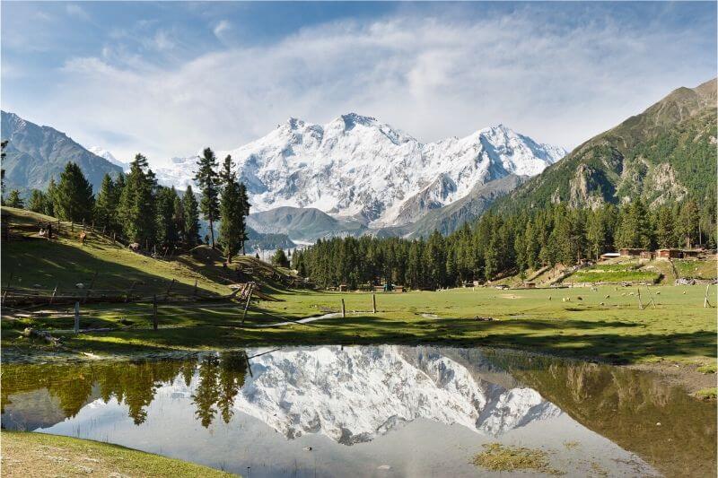
Fairy Meadows is the heart of exotic North Pakistan, It is located at the base of Nanga Parbat, which, at 8126 m, is the 9th highest mountain in the world and second in Pakistan after K2. The Fairy Meadows Cottages are at a distance of eight minutes hike from main village and other tourist resorts with its breathtaking natural view of great Nanga Parbat. The area in front of Fairy Meadows Cottages (in the picture above) is known as Pari Mahal (Fairy Palace), named by the famous Japanese photographer, Fujita Heroki.
The six-month tourist season at Fairy Meadows starts in April and continues until the end of September. Tourists lodge at the camping site spread over 800 hectares (2,000 acres), known as “Raikot Serai”. The site of Fairy Meadows, though partially developed, generates about PKR 17 million revenue from tourism, mainly by providing food, transportation and accommodation services. The road to Fairy Meadows was built by Brigadier M. Aslam Khan (M.C, H.J, F.K), First Commander Gilgit Scouts, which today employs the locals. The local community stopped the extraction of timber to conserve the forest and promote tourism in the area. The main attraction of this place other than the meadows itself is the view of Nanga Parbat Mountain. Tourists usually hike to the base camp of the mountain from Fairy Meadows.
KHUNJERAB PASS
Khunjerab Pass is a 4,693-meter-high mountain pass in the Karakoram Mountains, in a strategic position on the northern border of Pakistan and on the southwest border of China. Mutsjliga Pass is a 5,314-meter-high mountain pass at 36.97374°N 75.2973°E near Khunjerab Pass.
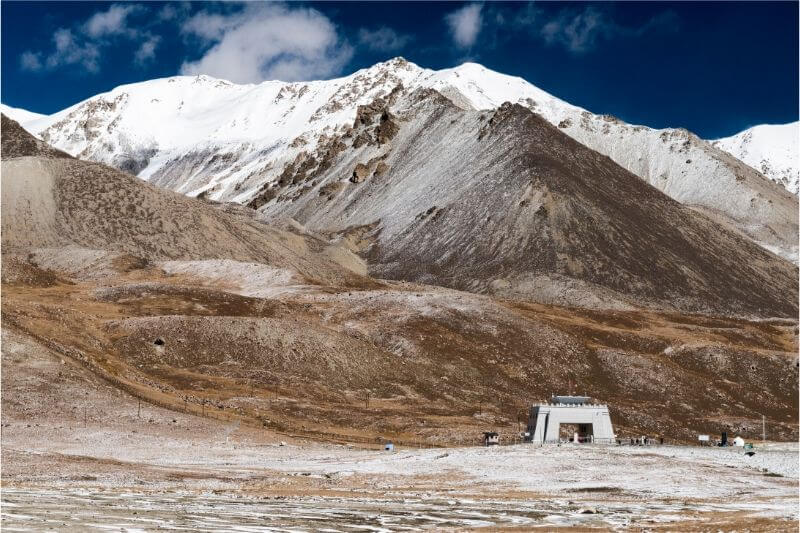
Khunjerab Pass has the highest automated teller machine (ATM) in the world and it is installed by National Bank of Pakistan (NBP). It is available 24 hours a day and 12 months a year. NBP has been awarded by Guinness World record for the World’s highest ATM at Khunjerab Pass. It is easier for tourists do not need to carry cash when visiting Khunjerab Pass simply draw money from the world’s highest ATM.
Khunjerab National Park is the third largest national park of Pakistan.From Khunjerab Pass you can travel to Khunjerab National park. Khunjerab National park is created in the 1970s.Khunjerab National park is famous for snow leopards. Tibetan wolf, Brown bear, Blue sheep, Marcoplo sheep, Red fox, Dhole, Wood mouse, Cape hare, and others are found in this park.




Leave a Reply